

A1. ST MICHAEL’S MOUNT
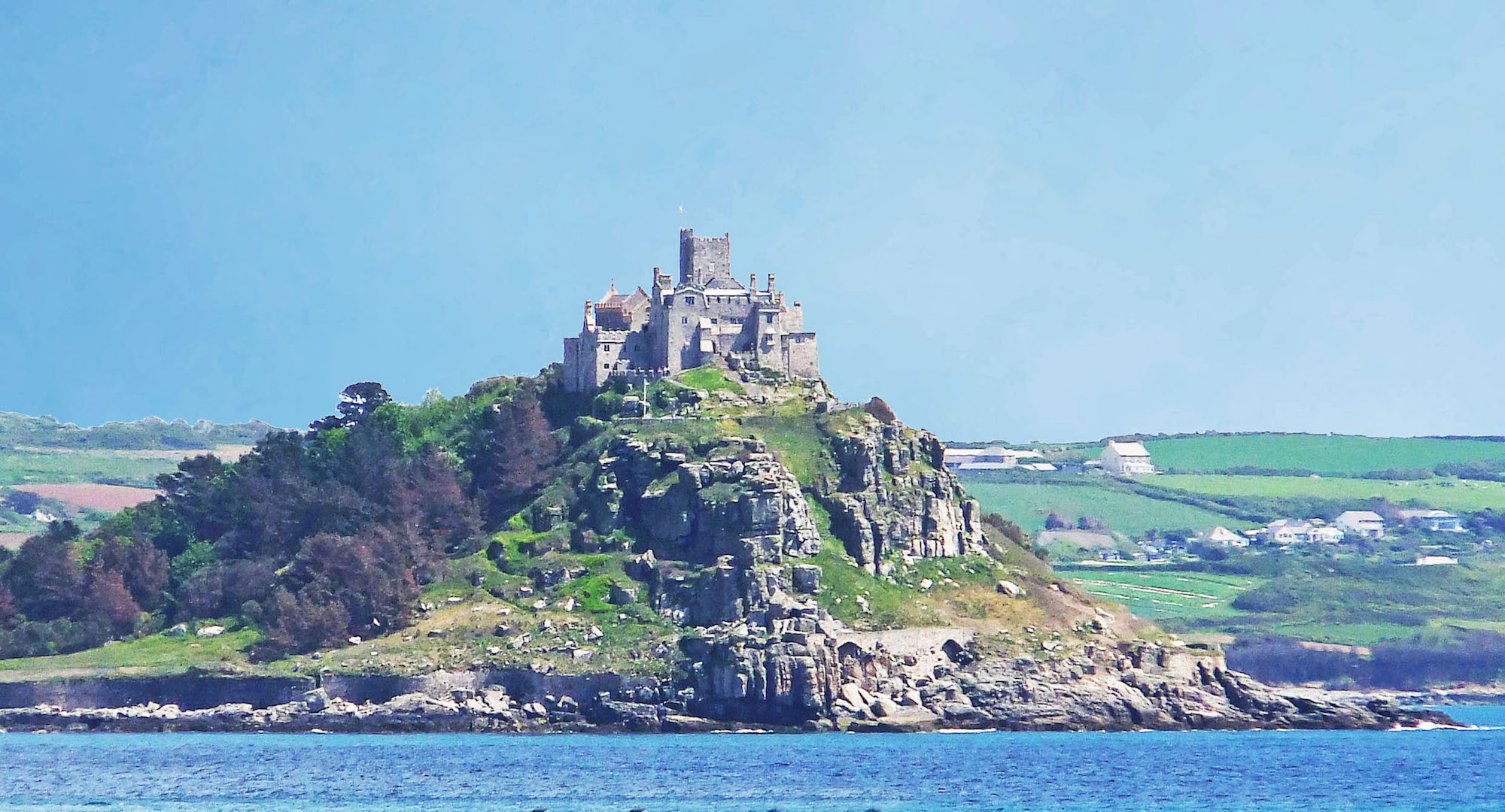
Photographers like their days to be sunny and their skies blue, but as we shall see, there is something appropriate in having dark foreboding skies when photographing St Michael’s Mount. Any island has an air of mystery, but even more so when that island is dominated by an historic old abbey. There are sure to be secret passages, and perhaps even skeletons in the cupboards! We look forward to a day of adventure tomorrow.
A2. VIEW FROM MARAZION
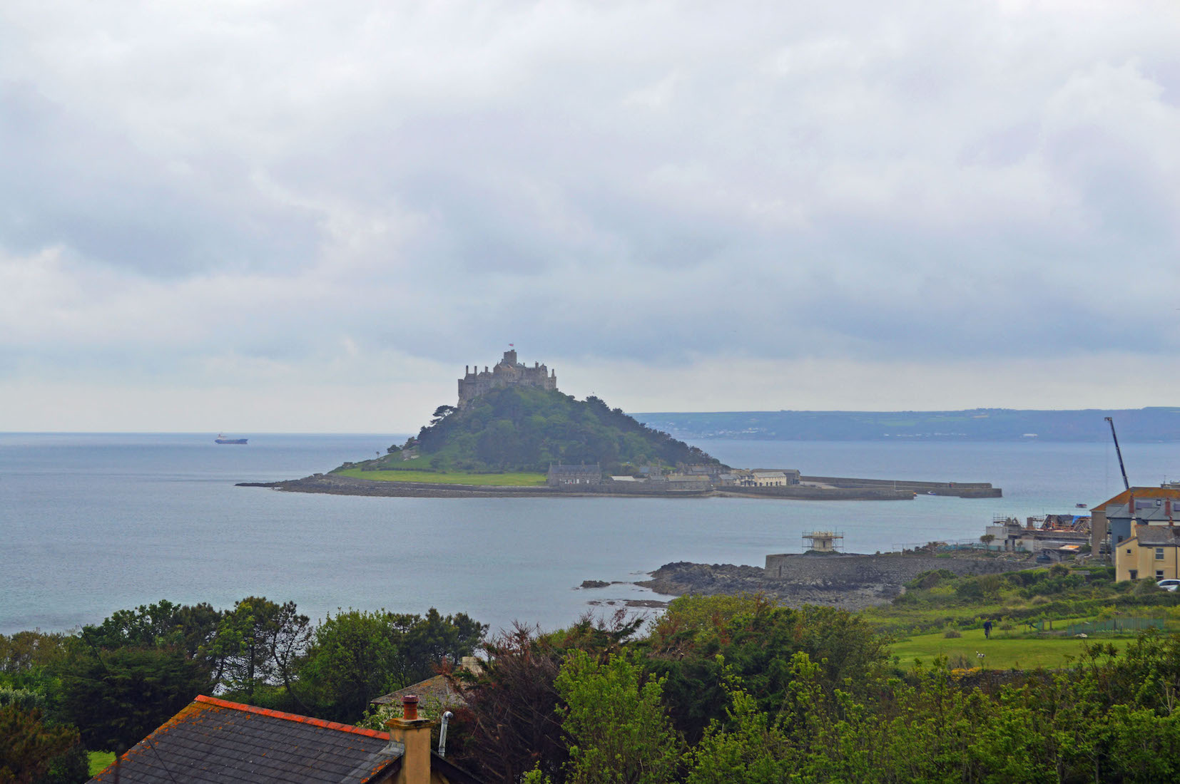
St Michael’s Mount draws the eye from every angle. Like a lighthouse or a mountain peak it becomes the focus of attention – at least for the visitor. In Cornish, the Mount is known as Karrek Loos yn Koos, meaning ‘grey rock in the woods’. It is a tidal island 366 m (400 yd) off the Mount’s Bay coast of Cornwall, in England. It is a civil parish and is united with the nearby coastal town of Marazion.
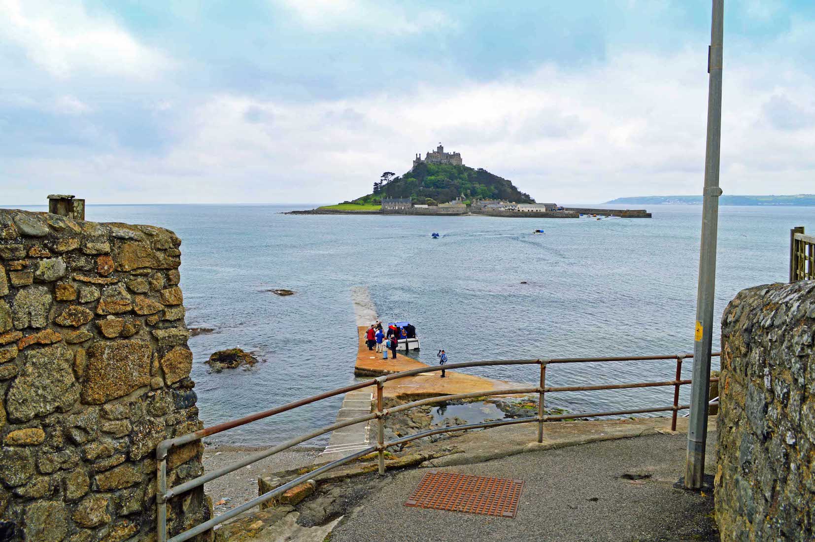
A3. FERRY CROSSING
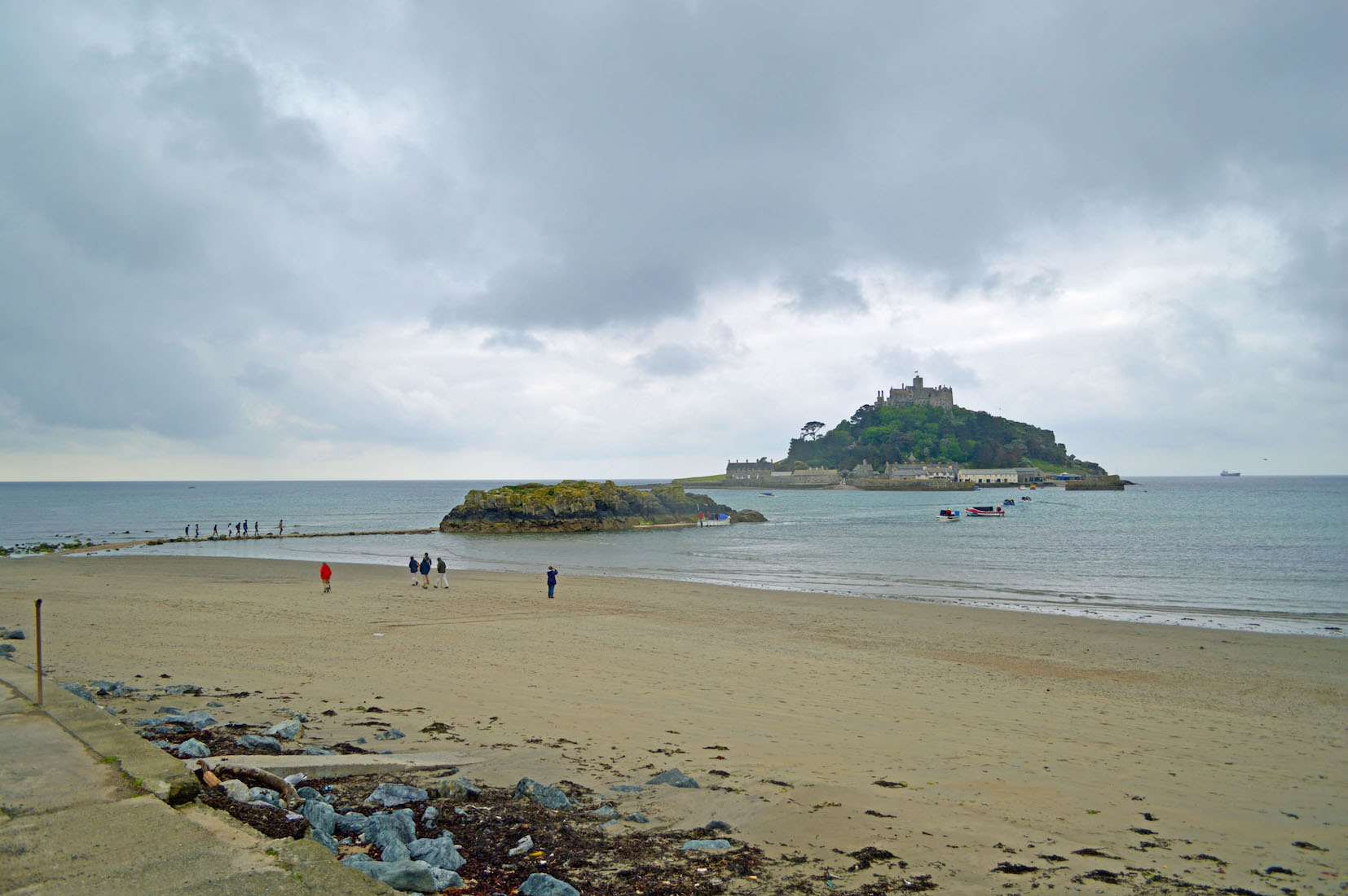
It is interesting that the ferry boats launch from different locations on the shore line as the tide rises and falls. This problem does not arise on the island, as there is a deep water harbour for disembarkation.
A4. THE NAME
From where did St Michael’s Mount get its name? Well, historically there was the close connection with Mont Saint-Michel in Normandy. However It is also claimed that St. Michael, the Archangel, appeared to local fishermen on the Mount in the fifth century AD.
A5. DOLPHIN VIEW
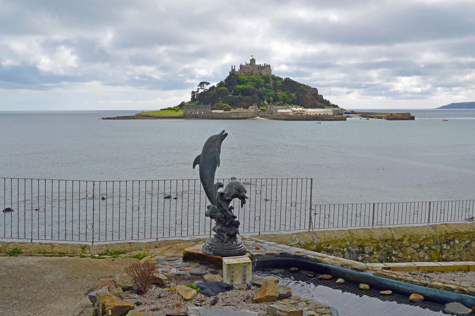
This dolphin water feature is on the shore in Marazion. Historically, St Michael's Mount was a Cornish counterpart of Mont Saint-Michel in Normandy, France, and shares the same tidal island characteristics and the same conical shape. In 1067, the monastery of Mont Saint-Michel gave its support to Duke William of Normandy in his claim to the throne of England. He rewarded this action with properties and grounds on the English side of the Channel, including a small island off the south-western coast of Cornwall which was modelled after Mont Saint-Michel, and became a Norman priory named St Michael's Mount of Penzance.
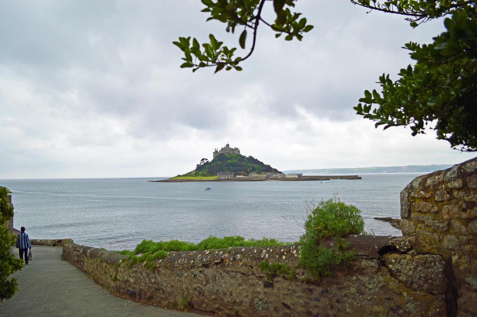
A6. THE CAUSEWAY
St Michael’s Mount is connected to the mainland by a man-made causeway of granite setts, passable between mid-tide and low water. At other times visitors will use the frequent and inexpensive ferry service provided by the locals with their small boats. The chronicler John of Worcester wrote that in the year 1099 St. Michael's Mount was located five or six miles (10 km) from the sea, enclosed in a thick wood, but that on the third day of November the sea overflowed the land, destroying many towns and drowning many people, and changing the landscape (seascape) for ever.
A7. ISLAND HARBOUR
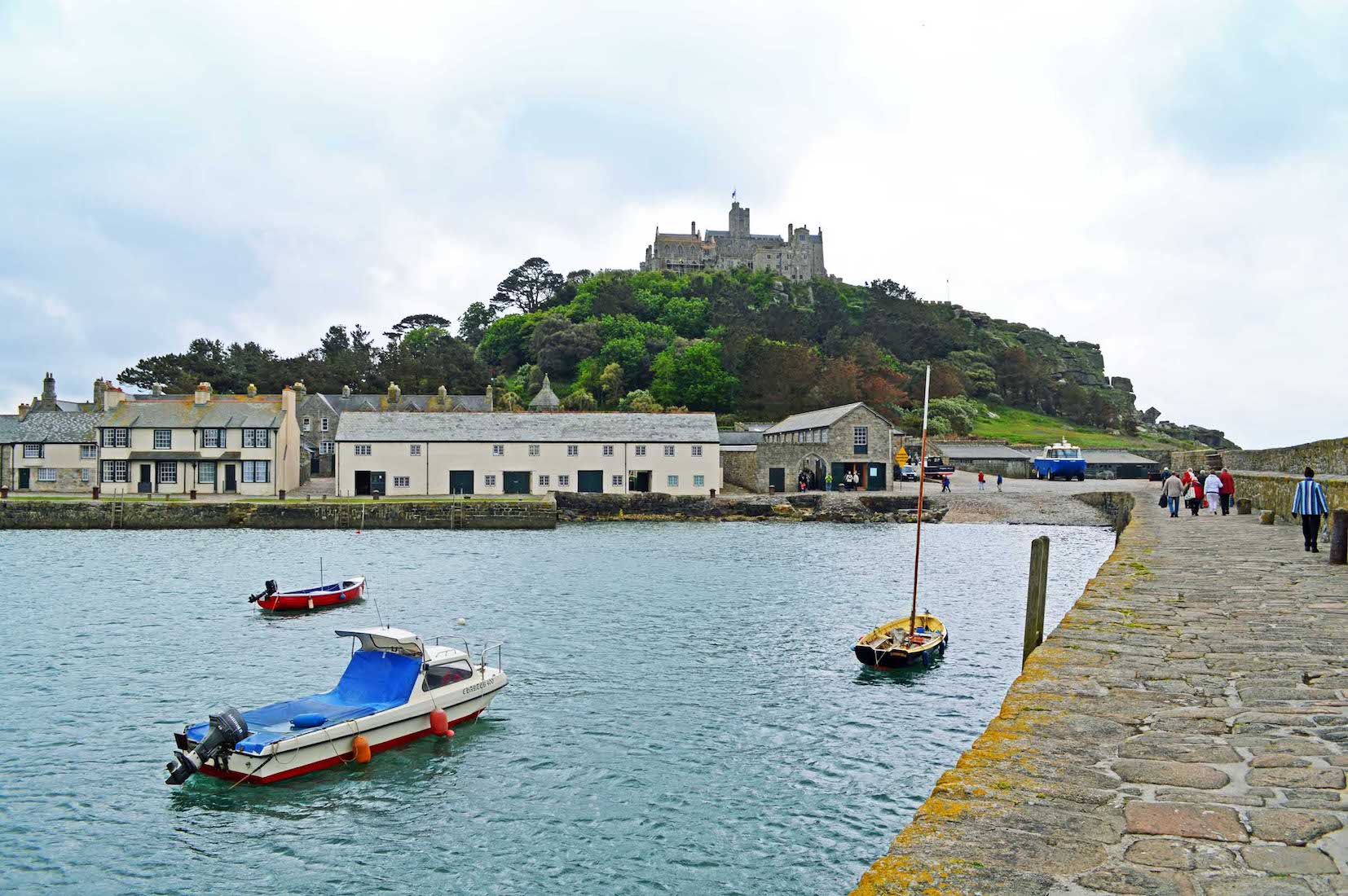
After a short trip across in one of the little boats, we arrive safely in the island’s small sheltered harbour. The castle stands facing us from the top of the hill, surrounded by trees in varying shades of green. In the foreground, a number of houses front onto the harbour in a small settlement. Little is known about this village before the beginning of the 18th century, save that there were a few fishermen’s cottages and monastic cottages. After improvements to the harbour in 1727, St Michael's Mount became a flourishing seaport, and by 1811 there were 53 houses and four streets. The pier was extended in 1821 and the population peaked in the same year, when the island had 221 people.
A8. HARBOUR ENTRANCE
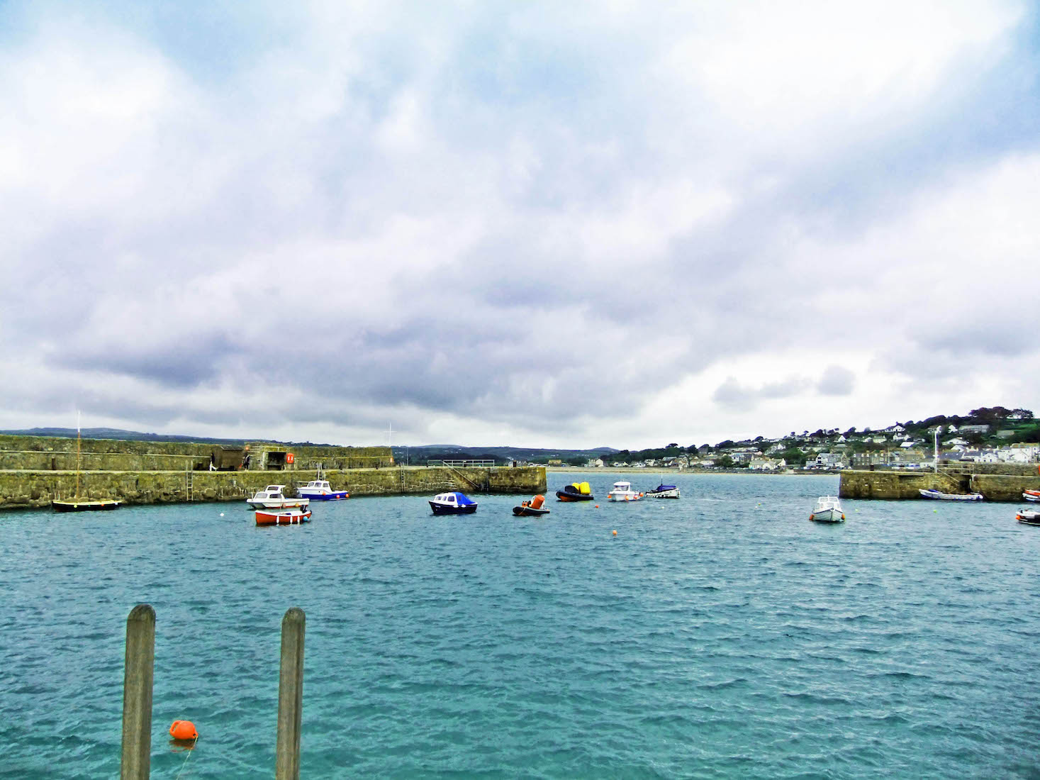
In St Michael’s Mount fishing port of the day, there were three schools, a Wesleyan chapel, and three public houses, mostly used by visiting sailors. The village went into decline following major improvements to nearby Penzance harbour and the extension of the railway to Penzance in 1852, and many of the houses and buildings were demolished.
A9. THE HARBOUR AREA
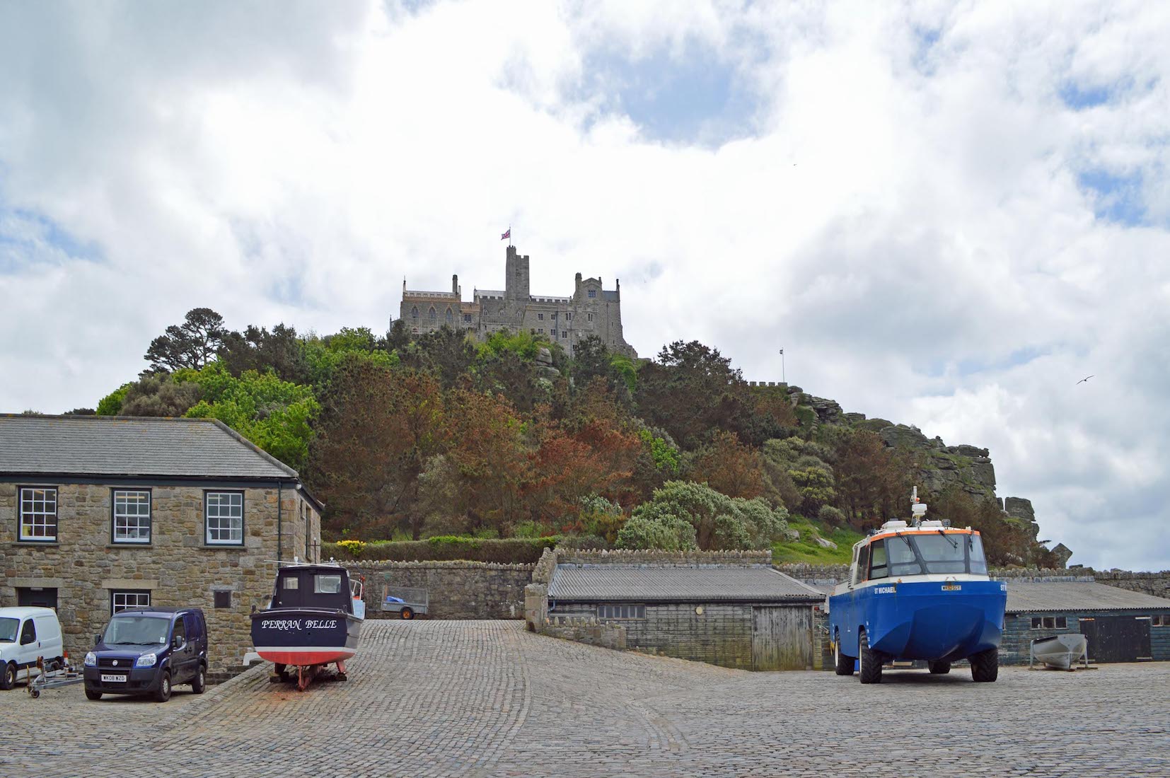
We are now ready to investigate the island more closely. On the way to the ticket office we pass this interesting amphibian vessel. The flourishing tourist trade has probably brought new life to the island.
A10. SATELLITE VIEW
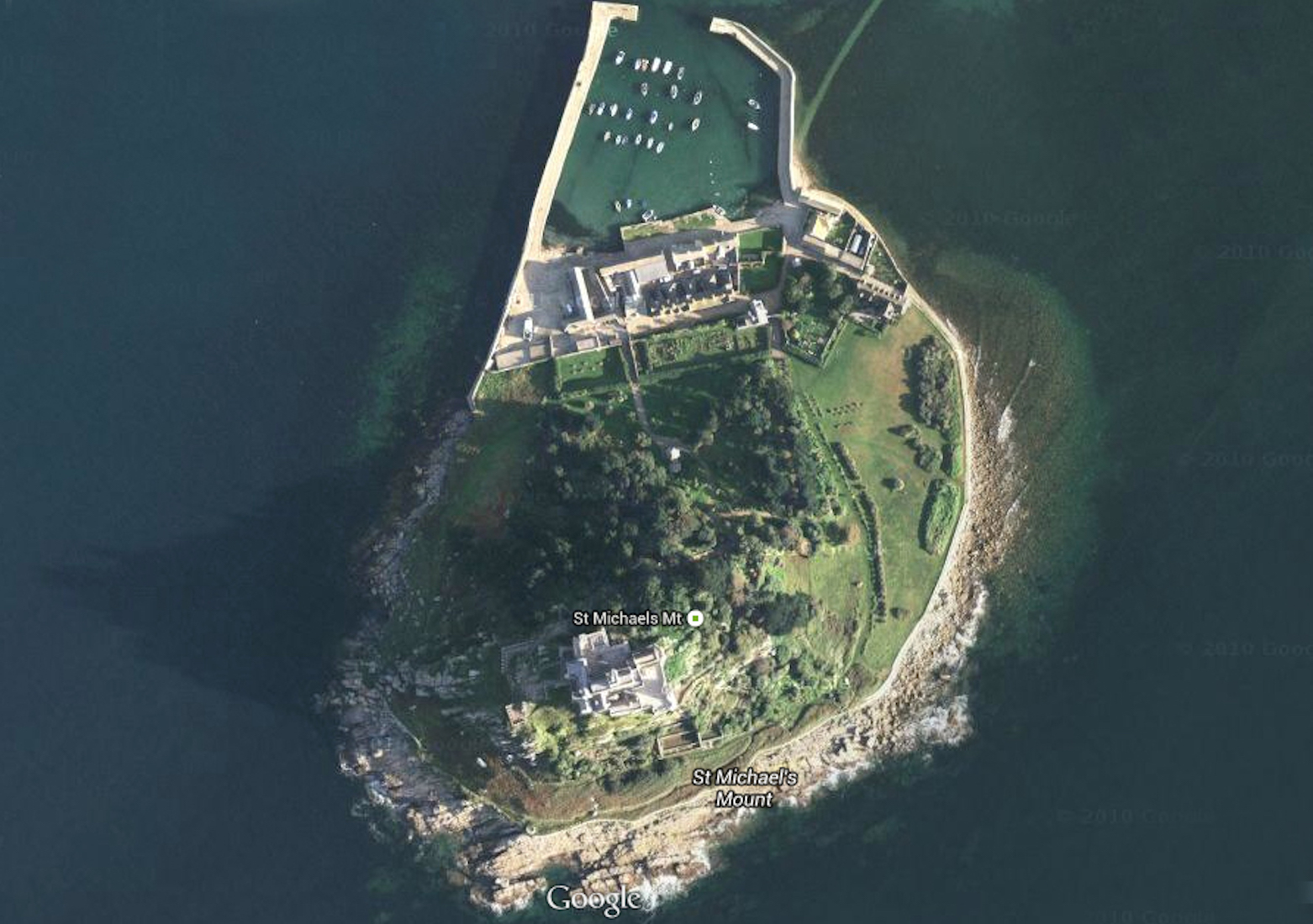
This satellite image gives us a good understanding of the island. At the north is the harbour, sheltered and well protected by its sturdy breakwaters. Facing the harbour are the remaining village houses, separated by a wall from the old monastery and garden. From the village a path rises up the wooded hill to the castle itself which is perched at the top of a cliff. Lawns to the east give access to a walled and rocky garden area to the south. There is no public access to the castle from this direction.
B1. MAIN ENTRY
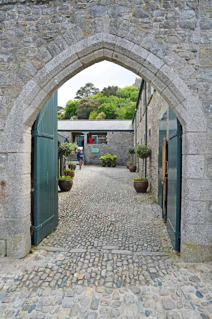
The main entry to the Castle complex is through this Gothic arched gateway.
B2. COBBLED COURTYARD
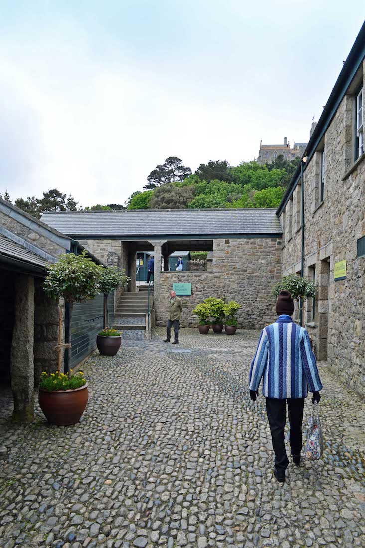
We enter into a neatly kept cobbled courtyard. The Castle peeps out above the grey stone walls, but the courtyard is surprisingly sheltered and warm on a cold morning.
B3. COTTAGES
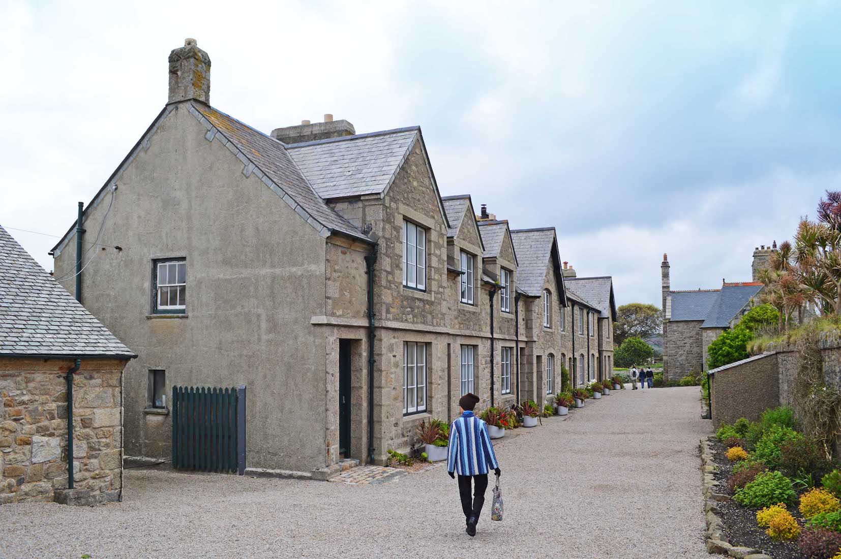
At the top of the cobblestone courtyard we turn left and walk along past this row of cottages. They are simple in structure but attractive in appearance, and set off by tubs of flowering plants. These cottages are still home to more than thirty islanders whose jobs range from boatman to gardener, guide to handyman.
B4. MAP
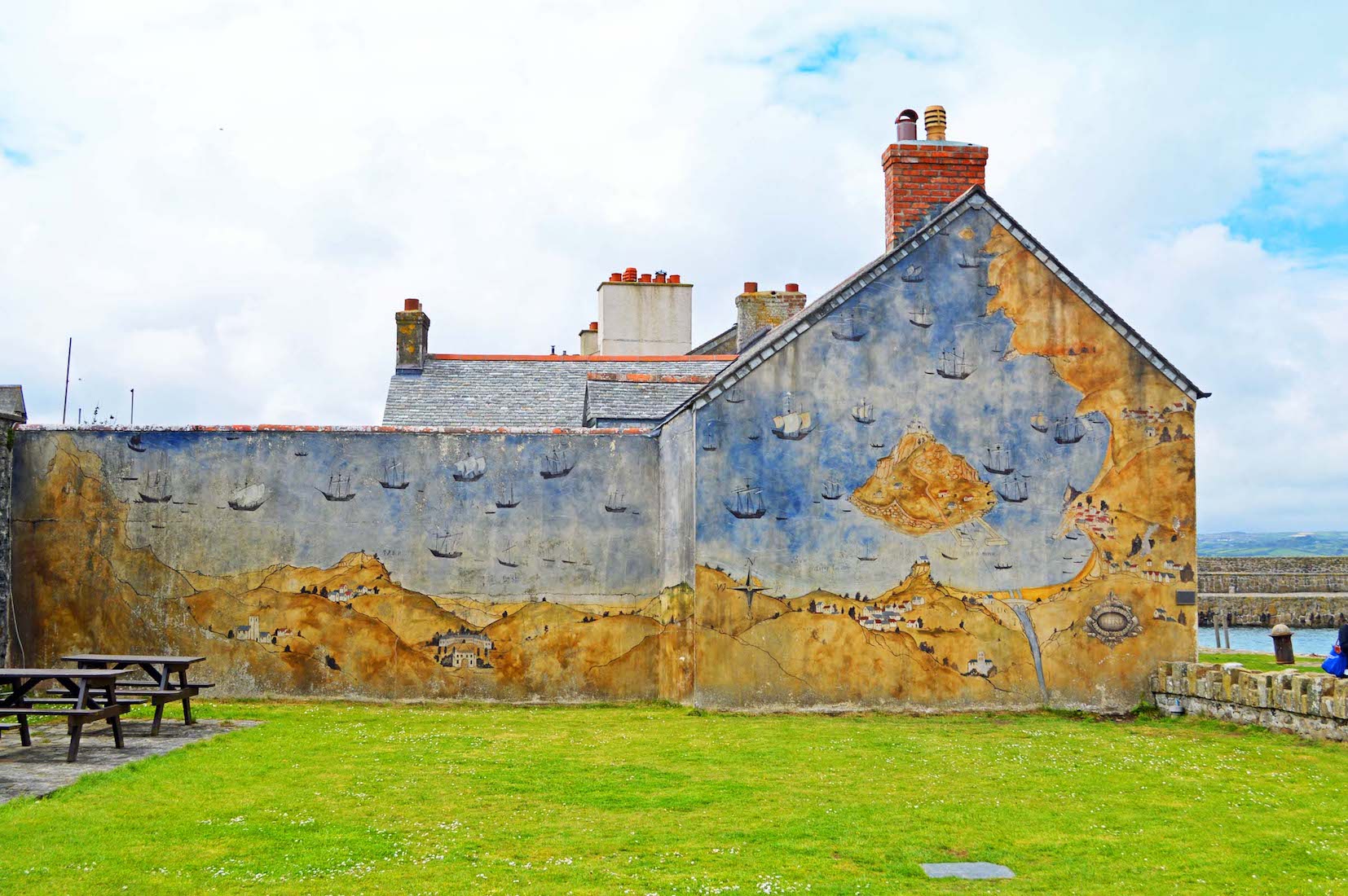
At first glance I thought that this end wall of the row of cottages was badly weathered, but closer inspection reveals a map of the bay and the island, along with prominent features of the mainland. There seems to be a whole flotilla of sailing ships in the bay!
B5. FINEST HOUSE!
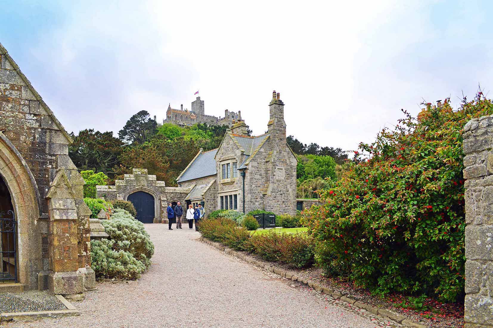
This is the finest looking house in the Village, and appears to have belonged to a family of some note, with the walls bearing a couple of family crests. The Castle can just be seen on the hilltop above. What name to use here? It was originally an Abbey, then became a fortified Castle, and is now in part a stately home. In his excellent book ‘A Personal Tour of St Michael’s Mount’ by owner James St Aubyn, the word ‘castle’ seems to be preferred, so we shall use this term.
B6. HOUSE DETAIL

Walking closer to the manor house, we are not disappointed. The stone work is of fine quality, and there are a couple of interesting crests – one is visible here above the double doors.
B7. CREST
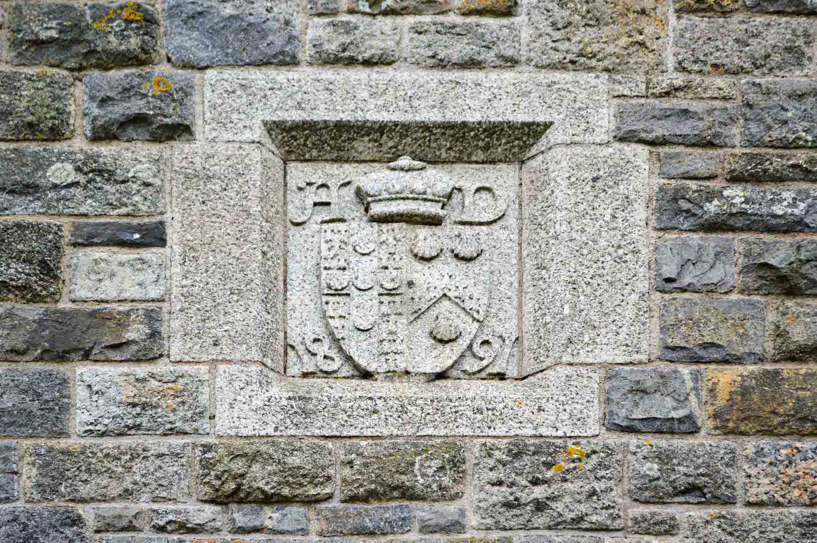
There are two crests to be found on the walls of the ‘manor house’. The first bears the letters H D and the date 1891. I can find little about this, except that a census of the Mount was held on this date.
B8. SECOND CREST
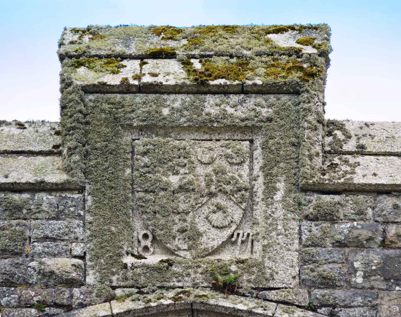
The other more weathered crest bears just the shield, along with the date 1877. The shield on each crest bears the St Aubyn family cross on the left. (This can be seen more clearly in the photograph #B7 above.)
B9. OLD CEMETERY
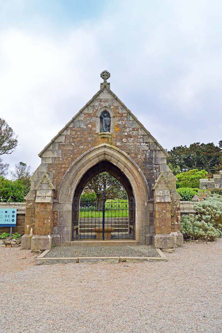
Near the ‘Manor House’ is an old cemetery. This is the gate house to the cemetery, but the gates are locked to the public. Above the entry is an angel carrying a lance and a shield, with a defeated Lucifer at his feet – St Michael of course.
B10. HEADSTONES
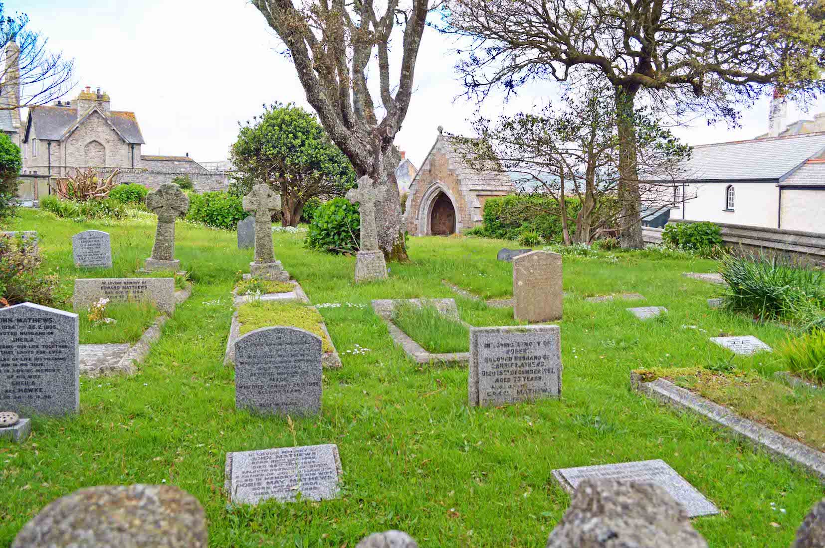
The island cemetery can be viewed only from a distance. It contains the graves of former residents of the island and several drowned sailors.
B11. MURAL
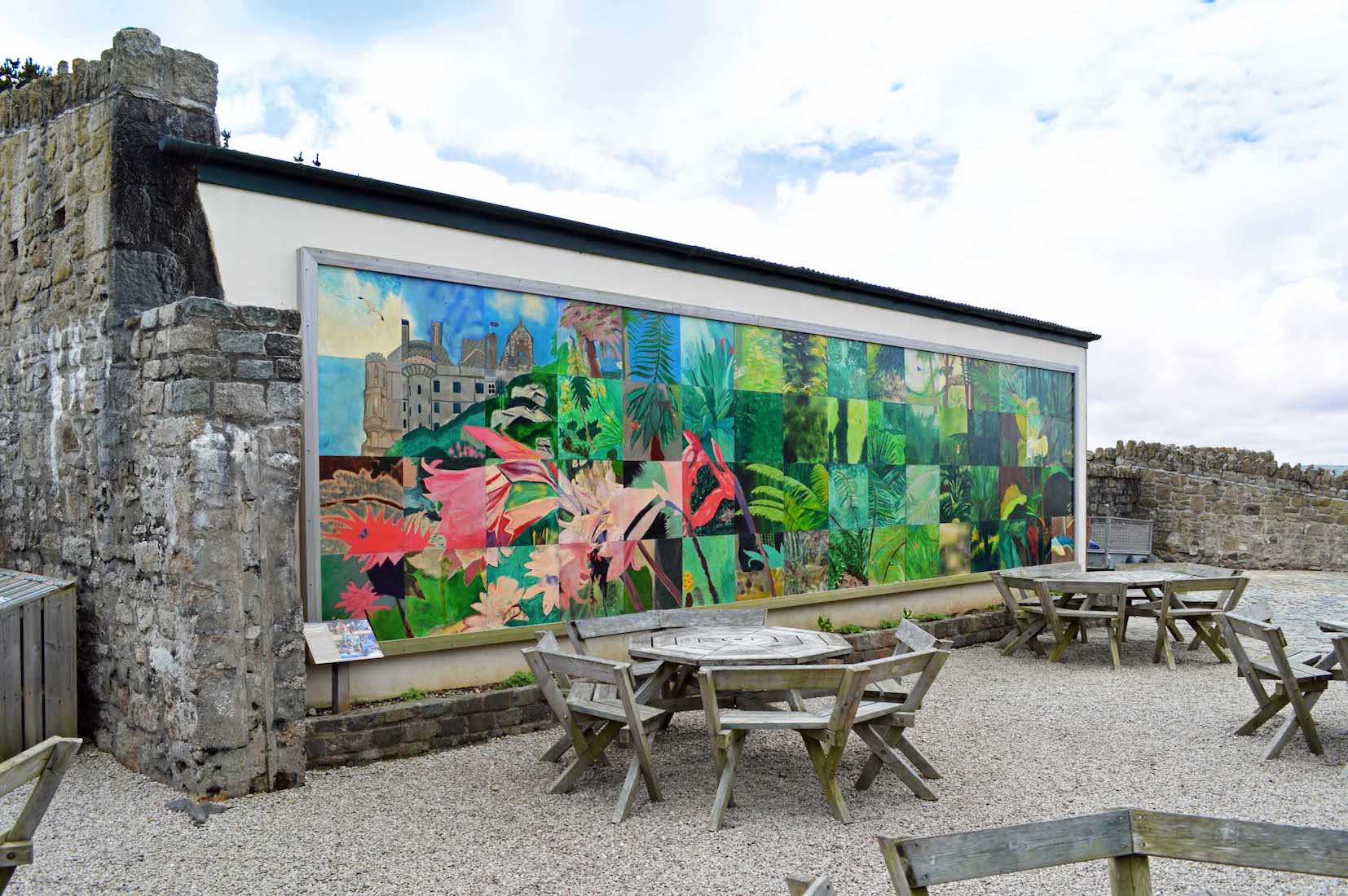
At least once during our visit we will feel obliged to patronize one of the island’s several eating places. This restaurant near the castle path has an outside dining area featuring this colourful mural.