|
BROWNHILL CONSERVATION PARK |
||||||
|
BROWNHILL >
|
||||||
|
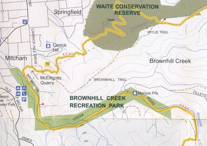
The Brownhill Reserve is situated at the southern end of Carrick Hill Drive and adjoins the Mitcham Council property of McElligotts Quarry to the west, Carrick Hill Estate to the north and private land to the east and south. Broadly, it is located between the Waite Conservation Reserve and Belair National Park. Access to the Reserve is via an existing unmade section of Blythewood Road that runs off Carrick Hill Drive and connects with a small section of the Reserve. Brownhill Creek runs through the Reserve. The following map shows the Yurrebilla Trail in yellow.
In 1998, there was some intense lobbying by community groups to save this part of the Hills Face area. Mitcham Council then purchased Brownhill Reserve with the assistance of both the State Government and the Carrick Hill Foundation.
|
||||||
|
BROWNHILL >
|
CREEK | |||||