|
CLELAND CONSERVATION PARK
|
||||||
|
CLELAND >
|
||||||
|
|
|
|||||
|
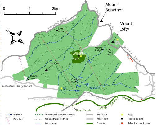
Detailed map (use magnifier and sliders): Areas around Waterfall Gully and the Mount Lofty Summit were declared protected in 1912, but it was not until 1945 that the remaining area was purchased by the government in public auction. This action was largely due to Professor John Cleland who had been lobbying on this issue since 1924. The land was transferred to the National Parks Commission in 1963. Later the three parcels of land were combined as the present-day Cleland Conservation Park. |
||||||
|
CLELAND >
|
||||||
|
|
|
|||||